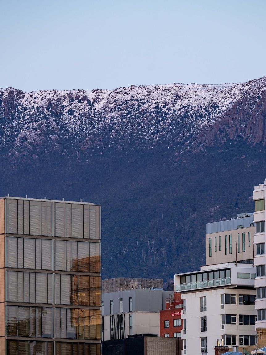
Spring’s infamous variability will be on full display this weekend, delivering a blast of cold Antarctic air and potentially the coldest September weather in decades.
The frigid air already reached Tasmania overnight, dropping snow to near sea level around Hobart, and will sweep across Victoria today, then surge up the New South Wales coast and ranges overnight.
A second wave of cold air should then arrive midweek, and possibly a third next weekend, bringing additional bursts of snow and well below average temperatures.
A weekend to rug up for south-east capitals
Summer may be on the horizon, but this weekend people in south-east Australia are best advised to retreat by a wintry fire.
The sudden cold snap is due to the arrival of a powerful front from the south, which will introduce a polar air mass from the Antarctic ice sheet.
The coldest air will drift over Tasmania and southern Victoria today, sending temperatures as much as 10 degrees below average.
Hobart is forecast to struggle to a high of just 10C, although some modelling has the city remaining below 9C — three below their mid-winter average and potentially the coldest spring day this century.
Melbourne will spend Saturday rugged up through a high of only around 11C or 12C, a 20-year low for spring if it stays below 11.7C.
Saturday afternoon will deliver temperatures below 10C to much of south-east Australia, while northern NSW enjoys highs in the mid-twenties. (ABC News)
The southerlies will also bring showers, small hail and the odd thunderstorm to southern Victoria and Tasmania through Saturday. And while severe storms are unlikely, large amounts of hail could accumulate on the ground.
Sunday will remain icy across Tasmania and Victoria, and the cold air will also surge up the NSW coast, dropping Sydney’s high to 17C – the coldest weather in a month.
Fresh southerly winds will also bring a substantial wind chill this weekend, with most regions feeling at least a few degrees cooler than the ambient air temperature.
Snow to near sea level could turn Hobart’s suburbs white
While our coastal capitals shiver, the ranges will be literally freezing, allowing for the most widespread snowfalls so far this year in some regions.
Tasmania will see consistent snowfalls through Saturday to an elevation of between 200 and 400 metres, with at least 10cm likely to accumulate across the southern and western highlands.
The low-level snow will impact large sections of the state, prompting the Bureau of Meteorology to issue warnings for road users in all districts apart from the north.
Some of the larger towns likely to see snow include Waratah, Fern Tree, Oatlands and Bothwell.
Hobart is often protected from the coldest and snowiest winter fronts by Mt Wellington, however the current system’s trajectory, arriving directly from the south, will bypass Kunanyi and bring heavier precipitation up the River Derwent.
Saturday is expected to bring consistent snowfalls across Tasmania. (Supplied: Julie Smith)
This favourable wind direction increases the likelihood of a dusting of snow over Hobart’s higher suburbs.
For the mainland, the path of the coldest air favours Victoria’s Gippsland, as opposed to higher alpine areas which pick up heavier snow when winds are westerly.
Areas of south-east Victoria above 1,000m elevation could see 15cm of snow during the next 24 hours, while a dusting should lower to around 600m in the east.
For NSW, the heaviest snow will arrive this evening in the state’s south-east around Bombala, Nimmitabel and Cooma where snow should lower to around 700m.
Snow will ease on Sunday to just a few flurries in most mountain regions, although a few flakes could extend right up to the Barrington Tops in northern NSW.
Spring see-saw to deliver frost and more snow midweek
While daytime temperatures will slowly climb into the new week, overnight minimums will plummet across inland areas, resulting in widespread morning frost on Monday and Tuesday.
Canberra’s forecast minimum of -4C on Monday is only 3C off an all-time spring record.
The new week will start with widespread frost over the south-east inland as cold air lingers behind the weekend front. (ABC News)
Milder weather will then arrive by midweek, but the spring warmth will be temporary, as another broad mass of polar air tracks directly over south-east states later Wednesday and Thursday.
Modelling indicates this second wave won’t quite match the intensity of the first but will still bring snow below 1,000m.
For Tasmania the snow should be heavy and combined with persistent rain at lower elevations all week, the state faces another round of flooding.
Seven-day totals should easily exceed 100mm over western Tasmania, and considering the wet catchments this should trigger rapid river rises and another round of flooding.
Well over 100mm of rain and snow should fall over western Tasmania this week, enough to trigger another round of flooding. (ABC News)
A third strong front could then arrive over south-east Australia next weekend, and while it’s currently too far ahead for a precise forecast, it has the potential to bring another round of wintry showers, hail, and highland snow.
While three spring snowfalls in the space of a week is irregular, it’s too little too late for the ski season which is already winding down after record August warmth prematurely melted the cover.
Only one resort, Perisher, remains open with skiing restricted to only a handful of regions with prior snowmaking.


