Australia is not off the hook for hot summer temperatures and a heightened bushfire risk, despite heavy rain currently falling across the east.
Key points:
- Large parts of Queensland, New South Wales and the Northern Territory have an “increased risk of fire” this summer
- AFAC says the recent rains are welcome, but unlikely to undo the damage of a dry September and October
- BOM’s official summer outlook will be released later on Thursday
The Bureau of Meteorology’s (BOM) official summer outlook, released on Thursday, paints a picture of a scorching summer, with all corners of the country strongly tipped for above average temperatures.
A significant portion of the country is also three to four times more likely to be “unusually warm”.
This is particularly likely for the southern half of Western Australia, Queensland east coast and tropical north, and the far north of the Northern Territory.
“So in terms of the temperatures that we’re forecasting for summer, we’re still looking at really quite emphatic odds for warmer than average temperatures, and reasonable odds for extreme temperatures,” BOM’s national manager for climate services Karl Braganza said.
Before: BOM’s summer outlook strongly tips hotter than normal temperatures across the country.. . After: A significant portion of the country looks to have unusually warm temperatures this summer.. .
Instructions: Use left and right arrow keys to control image transition
SLIDE
Following Australia’s driest ever September and October period, and a surprisingly wet November, the rainfall signals have softened to a promise of more “normal rain” for much of the country from December to February.
The exception is the northern part of Queensland, which is still likely to have a drier than normal summer.
The outlook tracks with the typical behaviour of the key climate drivers at play, including strong El Niño and the positive Indian Ocean Dipole.
While the Indian Ocean Dipole yields a strong influence on winter and spring rainfall, it deteriorates when the monsoon arrives in the Southern Hemisphere in November or December.
Meanwhile El Niño continues to influence hotter temperatures through summer, but its influence on rainfall is typically strongest during winter and spring, apart from Queensland’s Cape York Peninsula.
But Mr Braganza said the rainfall signals in the model were still a little unusual.
“Normally, when you get some rainfall outside of the tropics, it’s actually driven by the monsoon itself,” he said.
“So the fact that we’ve got continued predictions for dry monsoon neutral odds elsewhere, is interesting.
“It’s probably reflecting the fact that the water temperatures off the coast of New South Wales are extremely warm and so they’re providing that moisture to the atmosphere rather than it coming from the tropics.”
For northern Australia, the majority of Queensland and north-east New South Wales, which get most of their rainfall during the summer months, a return to normal is good news – particularly for the regions which have finished spring on severe rainfall deficiencies.
But for parts of southern Australia, where rainfall is typically scarce this time of year, a promise of “normal” rainfall won’t mean much.
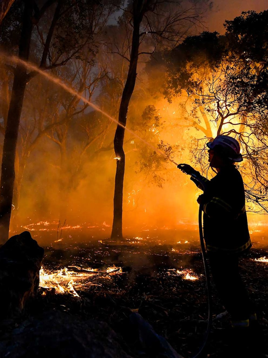
Summer bushfire outlook
The summer climate outlook coincides with the national summer bushfire outlook, released today by the Australasian Fire and Emergency Service Authorities Council.
Despite the recent deluges,, the Australasian Fire and Emergency Service Authorities Council’s (AFAC) Summer Bushfire Outlook, released today, paints large swathes of Queensland, New South Wales and the central Northern Territory in red for the season ahead.
It even includes parts of Queensland’s Far North, which is currently in its wet season, as having a “increased risk of fire”, which AFAC chief executive Rob Webb said was unusual for this time of year.
“It’s normally the wettest place in Australia at that time of year, through February and March, so it’s not what you’d say is normal,” he said.
The region has had a poor start the wet season so far, still yet to hit rainfall totals high enough to mark the official “onset” of the season.
Select parts of Tasmania, Victoria, South Australia and Western Australia have also been highlighted as having an increased risk of fire.
“That’s certainly of concern to fire agencies across Australia, that over the course a long, hot summer in Australia, that these fuels will dry out, and we might see quite dangerous conditions,” Mr Webb said.
“We really must treat the summer with respect, and that means really basic preparations that people need to be taking this time of the year.”
The bushfire outlook takes into account different land use and vegetation types, as well as the forecast temperature and rainfall over the regions.
“Damage already done” to dry fuels
Hefty rainfall totals have been falling across eastern Australia over the last week, smashing November rainfall records in NSW and delivering accumulated falls in excess of 200 millimetres to parts of Queensland.
Notably, the rain has fallen on the parts of the country that were facing the most severe rainfall deficiencies, including northern NSW and Queensland.
Mr Webb said it had “certainly changed the short term discussion”.
But he said the recent rain was unlikely to undo the damage caused by September and October, which was Australia’s driest on record.
“I’d say a lot of damage is already done through the spring period, and the abundant grassland fuels drying out, so we have to be mindful of that,” he said.
“If we return to a fairly normal summer [rainfall] period, it does help on the coastal strip in particular, but just remember that normal summer rainfall for much of Australia is still not a huge amount.”
But he said the recent rain was unlikely to undo the damage caused by September and October, which was Australia’s driest on record.
“It’s important to acknowledge that it’s been a busy season already, and there’s lots of people and lots of first responders that would be feeling the pain of losing their colleagues and family members, so it’s a really sad time.”
But he said fire authorities were feeling ready for the season ahead.
“We’re primed in terms of aircraft, primed in terms of the training, and also we’ve had the opportunity to exercise the resource sharing, keeping really close links between each other, to make sure that we can jump on any challenges that might occur,” he said.
Posted , updated