A new $50 million national fire danger rating system will be rolled out next month, replacing a system that is more than half a century old.
Key points:
- The updated fire danger rating will have four levels instead of six
- The system will use eight vegetation types instead of two to inform the fire danger rating on any given day
- Signs across the country will be uniform
Experts hope it will provide the community with clearer and more consistent messaging about the fire danger in their area on any given day, and make it easier for firefighters to understand how a fire might behave if one breaks out.
Australian and New Zealand National Council for Fire and Emergency Services project manager Simon Heemstra said the system’s streamlined messages would be easier for people to understand.
“What we found was people were getting confused with too many levels and what to do in each of the situations, so we’ve simplified the messages and the calls to action,” Dr Heemstra said.
“We’ve also introduced much more national consistency.”
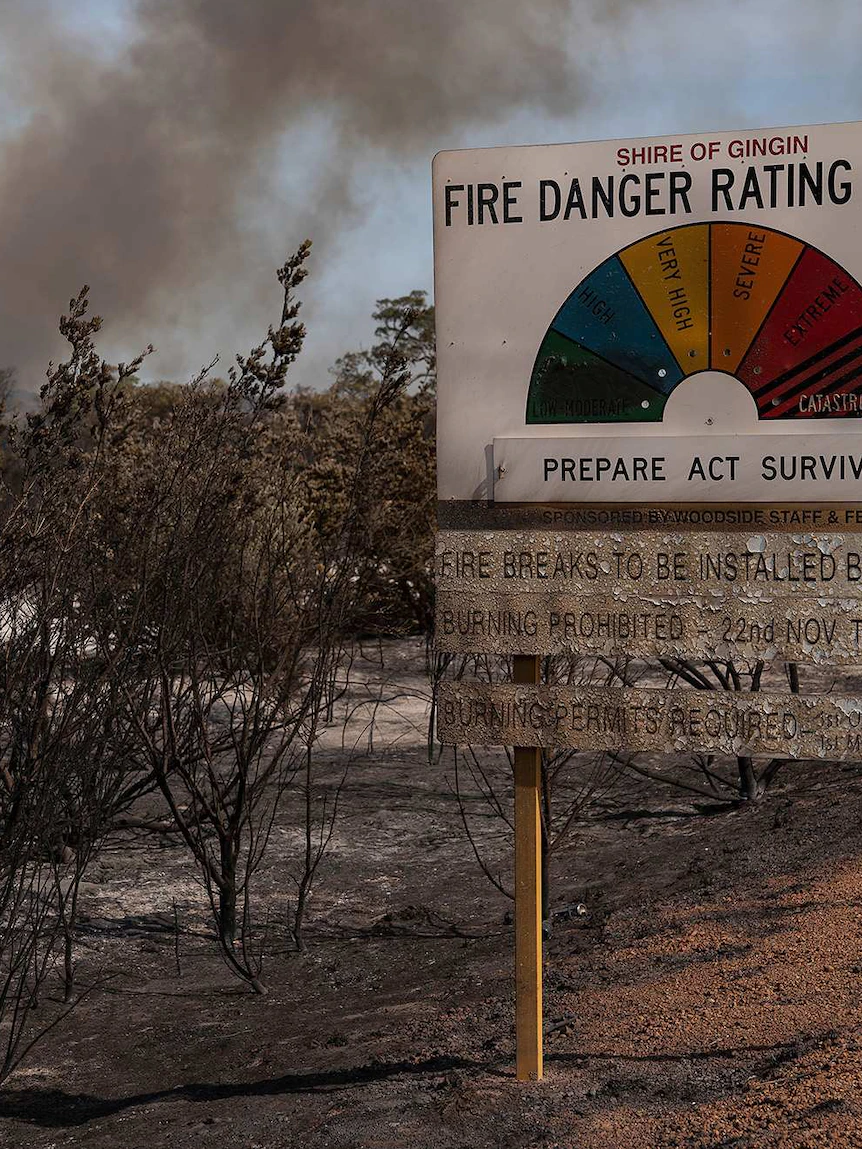
What are the changes?
Currently, there are six fire danger rating levels ranging from low/moderate to catastrophic, while the signs in different states and territories look completely different.
From next month, there will be four levels: moderate, high, extreme and catastrophic.
Signs in every part of Australia will be uniform.
The science behind the signs has also improved significantly.
The New South Wales Rural Fire Service’s lead scientist on the project, Stuart Mathews, said data collated from around the country about different vegetation types, along with improved weather predictions, would inform which danger rating applied to a location on any given day.
“There’s a really wide range of vegetation across Australia which wasn’t represented in the current system,” Dr Mathews said.
“We’ve worked together with the states and territories and some of the national agencies to get their best vegetation and fuel information and put that all together in a consistent way, which means we’ve got a detailed understanding of the fuel that’s driving fire danger across the entire country.”
In the old system, two types of vegetation — forest and grass — are used to determine the fire danger rating.
The new system uses eight — forest, grassland, grassy woodland, shrubland mallee health, spinifex, button grass and pine.
But Dr Mathews stressed fire behaviour was unpredictable, and no science could fully predict what would happen when a fire broke out.
“We tested our current system and our new rating system against 300 fires over past seasons and we found the current system was correct in describing risk for less than half of those fires,” Dr Mathews said.
“For the new system it’s up to about two-thirds so there’s still room for improvement, but in the fire space where there’s a lot of uncertainty, that’s a significant improvement.”
Agencies, bushfire victims welcome changes
Greg Webb’s home was one of 89 destroyed near Conjola on New Year’s Eve 2019, when the Currowan bushfire tore through the NSW south coast holiday village, killing three people.
Mr Webb has only just started to re-build after spending two years researching how to make his home fireproof.
He said having this sort of new danger rating system, along with a better understanding of the vegetation earlier, could have saved lives.
“Understanding this environment, this fantastic environment we live in, definitely it would have an effect, the more education we have about where we live and what we do would definitely save lives,” Mr Webb said.
The new system rolls out nationally on September 1.
RFS commissioner Rob Rogers said NSW firefighters would use the more accurate danger ratings to allocate resources if a fire broke out.
“What it will allow us to do particularly ahead of fires starting, it’ll give us an understanding as to where we should position resources, where the highest risks will be on a given day,” he said.
He also said there was room to change the system as the science evolved, and use it for other aspects of fire preparation in the future.
“Ultimately things like buildings will be able to be built to a more accurate standard and hopefully in some cases, that will reduce construction costs for people.”
Posted , updated