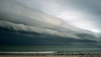
Widespread rain and thunderstorms, carrying the risk of flash flooding, have begun pouring over parts of Victoria and New South Wales, as a low pressure system intensifies over the eastern states.
Key points:
- Flood warnings are in place for parts of southern NSW and eastern Victoria following heavy rain
- Falls of 10mm to 50mm are forecast for parts of NSW and Victoria today
- The rain is a welcome relief for firefighters in Victoria’s Gippsland region, who have been battling bushfires for days
Over the past 24 hours, about 130mm of rain has fallen in parts of Victoria’s alpine areas, while on the South Coast of NSW lighter rainfall of between 1-10mm has been recorded.
The rain has helped to ease pressure on firefighters who have been battling blazes in Victoria’s Gippsland since the weekend, with fire warnings downgraded, but flood warnings have now been issued for other parts of the region.
On the NSW southern coast, a fire at Coolagolite has been downgraded to watch and act, but it is still too dangerous to return as the fire continues to be driven easterly by strong winds.
The Bureau of Meteorology (BOM) has issued several severe weather alerts and flood watches across Victoria and NSW, warning of cold weather, heavy rainfall, storms, wind and hazardous swells.
“It’s a significant weather system, with broad rain, including some really high totals across the eastern Victoria area,” senior meteorologist Angus Hines said.
“To add into that, we’re going to see strong winds, as well as some cool weather coming, which could mean some snow around the alps.
“We’re likely to see some hail and some very large waves all associated with a deepening low and passing front.”
Rain, wind, storms and snow
Broad areas of rain are expected to fall throughout eastern Victoria and south-east and inland NSW today, with forecast falls between 10 and 50 millimetres over the course of the day.
But Mr Hines said the heaviest falls would be over the Gippsland region, which had been battling emergency-level fires since the weekend.
He said significant falls, totalling over 100mm over the course of two days, were forecast for the region until mid-Thursday.
“For some places that would represent around about two months’ rainfall over approximately 48 hours,” he said.
“So, it’s a big shift in the weather that will help to quell the fire risk.”
Similar heavy falls are also expected through south-eastern parts of NSW, including the Riverina.
This morning, severe weather warnings were in place for large parts of southern NSW and east of the Victorian ranges.
Damaging winds are expected in Victoria, and in NSW alpine regions, followed by wind gusts of up to 90kph in the central and southern ranges, extending to the Illawarra and South Coast regions on Thursday.
On Tuesday afternoon, SES chief officer Tim Wiebusch urged Victorians to be alert to flash flooding.
“Do not attempt to drive through those flash flood waters, it may be the last decision you make,” he said.
Mr Hines said today’s wet weather would be met with the chance of thunderstorms, strong winds and large swell, particularly across the New South Wales ranges, western slopes and inland plains.
“There’s a broad thunderstorm risk area too, as this whole weather system crosses NSW,” he said.
“Large parts of the interior of the state have a chance of severe thunderstorms, which could bring on further damaging wind gusts as well as localised areas of heavy rain and hail.”
A hazardous surf warning has been issued by the BOM for most of the NSW coast from the Macquarie to Eden coast.
Temperatures to plunge as system moves east
Further downpours on Thursday will add to the flood risk with rain forecast to become concentrated mainly around the Gippsland region and the south-coast of NSW, as the system tracks east to sit just offshore.
Strong to gusty winds will also pick up through the Gippsland coast on Thursday morning, according to the BOM, as well as the NSW South Coast and Tablelands.
By Friday, most of the rainfall is forecast to have eased.
But the wintry weather will be far from over, with south-eastern states likely to be hit with a dramatic cool change and alpine snow in the wake of the system.
A large pool of cold air will see temperatures drop to between 4 and 12 degrees Celsius below average today, according to the BOM, from the eastern half of Western Australia, across South Australia, and into inland NSW, far western Queensland and Vic.
By Thursday, most of NSW, western Queensland and the northern part of SA will be between 6C and 8C below average.
On Friday and Saturday, the biggest temperature anomalies will be focused around western NSW and far eastern Victoria, however, temperatures will remain below average for most of eastern Australia.
Mr Hines said there could also be snowfall down to 800 metres for Tasmania on Friday, and to 1,400 metres, for the alpine regions of Vic and NSW on Thursday and Friday.
Relief to parched land
The spring downpour has been welcomed by farmers, particularly across the east coast of NSW and Victoria, where rain has been scarce.
Data from the BOM showed September was very dry, with most of Australia receiving below-average rainfall, compounding the impacts of an overwhelmingly dry winter across large parts of southern Australia.
After a “very, very” dry winter and spring, Orbost cattle producer Chris Nixon said he was preparing to de-stock his property if decent rains did not arrive soon.
“So far we’ve sold nearly 600 head of both beef and dairy cattle to take a bit of pressure off,” he said.
“One shower doesn’t make a spring, so we’ll still take a cautious approach and de-stock a bit further, but hopefully it rains and I can run with what I’ve got without too much drama.”
The Murray-Darling Basin Authority recently increased the amount of water it was releasing from Dartmouth Dam from 6,000 megalitres per day to 8,500ML per day, to prepare for heavy inflows over the coming days.
Meanwhile, a plan to increase the amount of water released from Menindee Lakes was put on hold.
“Due to the forecast rain, we anticipate being able to meet current demands without further increase in the releases from Menindee,” Murray–Darling Basin Authority senior director of river management Joe Davis said.
Posted , updated


