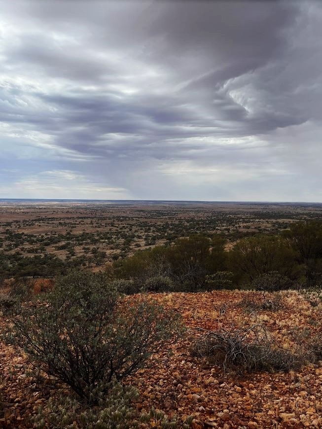
Former severe tropical cyclone Ilsa is set to dump rain across large parts of Australia and possibly bring damaging winds as it links up with a frontal system sweeping over the Southern Ocean.
Key points:
- Ilsa is expected to drop below cyclone intensity overnight
- Rainfall in several states is set to continue, however, and warnings are in place for the NT
- Farmers in SA say they feel for the people of WA, but they are welcoming the rain
The powerful storm ripped over the Pilbara as a category four just after midnight on Thursday.
Maximum wind gusts of 289 kilometres per hour were recorded at Bedout Island before the gauge “lost contact”.
Ilsa has now been downgraded to a tropical low but its remnants will continue to produce damaging winds as it continues its journey into the Northern Territory.
And the rain is set to continue for days with warnings of heavy falls and damaging winds in place for the Northern Territory.
Bureau of Meteorology senior meteorologist Jessica Lingard said as the system tracked east it would link with the cold front and drag tropical moisture from the Northern Territory into parts of South Australia from early Saturday.
“It’s providing a corridor of moisture for the two systems to link up, which allows that rainfall to fall in the northern parts of South Australia,” she said.
Damaging winds and heavy rainfall are expected to impact the south-west corner of the Northern Territory throughout Saturday, including Alice Springs later in the day.
Ms Lingard said northern parts of South Australia were expected to receive 10-30 millimetres of rain overnight and during Saturday, along with some heavier isolated totals.
Front to sweep over south-east
Ms Lingard said the cold front, which had already brought significant falls and hail to the south-west of Western Australia, would bring rain in south-eastern states later on the weekend.
“So on Saturday we will see rainfall across southern Northern Territory, northern South Australia, eastern parts of South Australia, and southern New South Wales and Victoria,” she said.
“Then on [Sunday] we see some higher falls in eastern parts of Victoria, south-eastern New South Wales, and Tasmania.”
Falls of up to 25mm are expected for southern New South Wales, much of Victoria, Tasmania and southern South Australia over the weekend.
Ms Lingard said much of Queensland and northern New South Wales would stay dry.
Hot and dry weather will continue in Queensland into the weekend before a cool change next week.
Rain ‘just gold’ for SA farmers
Farmers in South Australia have high hopes for what looks to be “perfectly timed” rainfall.
Gillian Fennell from Lambina Station in the state’s far north said she had been watching the system closely.
“I’m really sorry to West Australians because I don’t want to see them impacted negatively, but it’s been quite some time since we’ve had the opportunity to get a really good rain system over central Australia,” she said.
Ms Fennell said tropical systems often brought the best rain at this time of year.
“We would really like something heavy to fall down to start filling some dams so we can start shifting cattle back into areas that we’ve been spelling because we haven’t had water available to us,” she said.
Further south, in Kimba, in the upper Eyre Peninsula, grain and sheep farmer Peta Willmott has started seeding for the winter cropping program.
She was hoping for 20-40mm of rain.
“Rain now is just gold for us,” she said.
“We’re coming into our seeding program, we’ve started setting our pastures and a few legumes, and it’s just perfect timing, really.”
Ms Willmott said rain from recent years had built up subsoil moisture, but more falls would still be crucial for the establishment of crops.
She said this was especially important with the potential for a dry winter and spring under the influence of El Niño.
“Establishment means everything when you’ve got a dry year coming up,” Ms Willmott said.
People in southern parts of WA also welcomed the rain on Thursday as a cold front swept across the region.
Rainfall for the year so far has been average to below average for much of the southern half of Australia and parts of eastern South Australia, northern New South Wales, south-east Queensland and southern Western Australia are in need of a drink.
High rainfall from the last 12 months, however, is likely to have provided a buffer for most of the eastern half of the country.
Posted , updated


